
Having completed the life changing 33 peaks last year I’ve managed to keep my fitness at a reasonable level, and when my brother asked if I fancied entering a different mountain marathon I jumped at the chance.

This event was very different from the mountain marathons I’ve completed before, these being normally 2 day events, competed during the summer. This event was a two day mountain marathon rolled into one night and in the middle of winter! During the 33 peaks David and I managed to navigate successfully in the dark, so we were reasonably confident we would be able to repeat this.
The location was released a couple of weeks before and being Glossop in the Peak District it was a location that I was not very familiar with. Leading up to the event I checked the weather forecast and amazingly it looked like we were going to get a break in what has been a very wet winter, as long as we finished early on the Sunday morning before the next wet and windy spell set in.
We arrived in Glossop and went to the event centre at the sports centre, and after a compulsory kit check, we sat and waited to set off the start. Even though we were not due to be camping we still had to carry tent, sleeping bags etc., so we had full packs just to add to the difficulty.
At 9:40 pm we set off to the start, I think a number of the locals who were on a night out did wonder what was going on.

20 minutes later we arrived and after a couple of minutes more we got our map and we were off. We had entered a score class, which means we could visit as many check points in any order, but had to return to the finish in 8 hours.
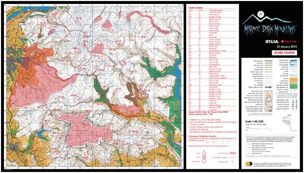
Each of the check points has a different value, and the higher the value the harder it is to find, or the further away from the finish it is. We took a quick look at the map and decided that our plan would be to make our way to Kinder Scout, where there where a number of high value check points on the far side. Prior to the start we had decided we would walk most of the way and run if the conditions allowed. So we set off up a reasonable track into the dark. After 30 minutes or so we hit our first navigation decision, after a couple of minutes we agreed and continued up onto the fells.

The first check point we were heading for was up a stream just off a major path. We continued up the path, crossing via a bridge, we then followed the stream. A couple of minutes later the first check point was found and we had 5 points. Heading up the steep stream sides we were soon back on the path and on our way up to check point 2. As we climbed up I was finding it hard to see the path mainly due to my head torch not being bright enough, but we carried on and soon we reached the second check point and another 5 points. We were now on the Pennine Way, which is a big path with slabs, and crossing the A57 we made good progress, but by now we were in cloud so the visibility was much reduced. To see if I could improve my vision I changed my head torch for a spare that I was carrying and it looked to be better. While crossing moving along the Pennine Way, we had considered picking up another check point close by, but we decided not to as the ground on either side of the path was very wet, as David found when he missed the slabs and went thigh deep into a bog. We continued and eventually reached our next check point for another 5 points.
After a quick descent we started to climb up to Kinder. We moved off the path and tried to find a fence that the check point was on. We found the fence after a couple of minutes and climbed up to find the check point. One thing we had started to notice was that our judgement of distances in the dark wasn’t what it would be in the daylight. We were over estimating the distances we were covering, and I think this is where we went wrong at this check point. We climbed and got to an area where we thought the check point should be, and looked around for it for 10 minutes or so. Needless to say we couldn’t find it, in fact the 3 other teams that we met up with also couldn’t find it. Being a 20 point check point this was disappointing. However we decided we would move on to the next check point and after consulting our compasses, as we had got very disorientated looking for this check point, we set off. By this time the cloud cleared and the lights of Manchester where clearly in view and that helped to show we were going in the right direction. By this time our plan to go to the other side of Kinder Scout had gone out of the window and so we simple traversed the north side to pick up so check points. So after 2 ½ hours we were going reasonably well. The edge of Kinder is hard going with areas of very wet peat, mixed with rocky out crops, and with a poor head torch I found traversing this very hard work.
We found the next check point quite easily, another stream (15 points), and moved onto another which was on a far east end of Kinder. Again we found this very easily (25 points). By now we had 55 points and after a quick detour south we had found another check point with 15 points. So 4 hours in we decided we needed to start heading back towards the finish. We descended from Kinder into a valley that lower down has the Ladybower reservoir. With my poor torch this descent was very hard, and much slower than I wanted it to be. We reach the valley bottom, and looking at the map made a very bad route choice. We had originally planned to head for a check point on the other side of a river, but as there was no bridge and the river looked quite wide we decided to climb the valley to a bridge and get another 20 point check point. The climb seamed to go on for ever and I was starting to feel very tired by this point but eventually we reached the bridge and crossed the river.

The check point was 60 meters above the bridge up a small stream. We found what we thought was the correct stream and started to climb up it. This was very steep and at times we needed to climb up the very narrow stream bed, I was not looking forward to coming back down it! We reached 60 meters up, David had an altimeter on his watch and started to look. At this point we realised we were on the wrong stream. We climbed out of the small valley and after a couple of minutes found the right stream and found the check point (20 points).
We had now been out for 6 hours and we knew it was going to be very hard to get back in time. We pushed on back down the valley finding the next 2 check points easily (5 points each) and reached a support point with a couple of marshals. At this point we had planned to make quick progress up the A57 back towards the top of snake pass, but the marshals showed on the map that this was not allowed, so we had to climb a steep stepped path and then traverse a steep path alongside a new fence with barbed wire on the top. This was horrible, trying to make fast progress without catching the barbed wire was just hard work, and once we reached the end of the fence and descended down onto the road I was happy. So now on the road we needed to make quick progress, in fact as we only had 5 minutes to get to the finish we knew we weren’t going to make it. It was just a case of moving as fast as we could and hope that some of the 105 points we had collected would be left, as you get points knocked off if you are after the 8 hours. We made great progress going down with a mix of running and fast walking we passed a couple of other teams and finally saw the lights of Glossop. By now the weather had started to close in and a mix of rain and snow was falling. We finally reached the finish but being 8 hours and 55 minutes after we started we knew we weren’t going to have many if any points left.

We walked back into Glossop and arriving at the event centre we got our result and as expected all of our points had gone and we were in last place. So not a great result, but in terms of what we had achieved I was happy, being out for 9 hours in the dark, in unfamiliar terrain, and not getting lost was a result in itself. Would I do it again, yes I think so, just with a better head torch next time.
Photographs included with kind permission from Marmot Dark Mountains and taken by Oli Scarff / © Getty Images
